Scientific Communications
Peer-reviewed articles, scientific reports, and conference proceedings
Filter by keyword or browse through all below
Keyword
- Aboveground Biomass
- Agricultural Employment
- Agricultural Expansion
- Agricultural Intensification
- Agricultural Yields
- Agricultural monitoring
- Augmented Visual Interpretation
- Belowground Biomass
- Carbon Stocks
- Climate Change Mitigation
- Collect Earth
- Cropland
- Cropland Dynamics
- Deforestation
- Development
- Drivers of Deforestation
- Dryland Forests
- Drylands
- ECOWAS
- Ecosystems
- Fallow cropland
- Field Size
- Forest Degradation
- Forest Restoration
- Forestry Plantations
- Global Assessment
- Google Earth
- Google Earth Engine
- Interdisciplinary
- Land Monitoring
- Land Systems
- Land Tenure
- Land Use
- Land Use Change
- Land Use Management
- Land use policy
- Large-scale Land Acquisition
- Large-scale Land Acquisitions
- Mali
- Mangroves
- Mapathon
- Mozambique
- National Forest Monitoring System
- Open Source
- Participatory GIS
- Pixel-based Compositing
- Remote Sensing
- Resource Frontiers
- Restoration Longevity
- Restoration Policy
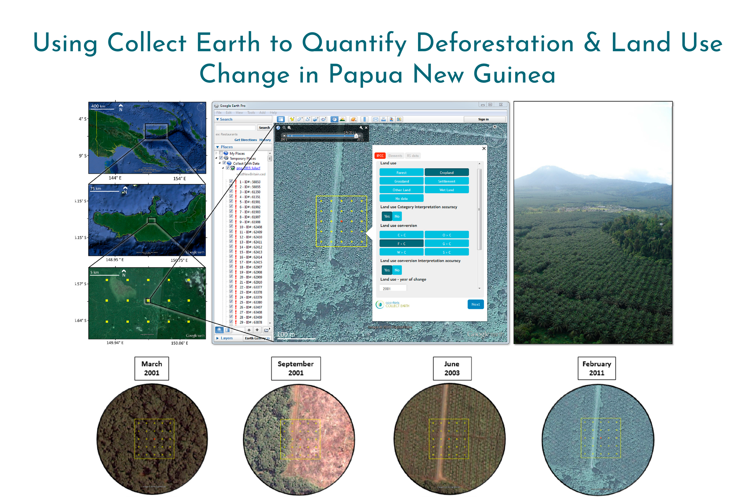
Collect Earth: Land Use and Land Cover Assessment through Augmented Visual Interpretation
Collect Earth is a free and open source software for land monitoring developed by the Food and Agriculture Organization of the United Nations (FAO). In this study, we provide a full overview of Collect Earth’s structure and functionality, and we present the methodology used to undertake land monitoring through augmented visual interpretation using Papua New Guinea as a case study.