Scientific Communications
Peer-reviewed articles, scientific reports, and conference proceedings
Filter by keyword or browse through all below
Keyword
- Aboveground Biomass
- Agricultural Employment
- Agricultural Expansion
- Agricultural Intensification
- Agricultural Yields
- Agricultural monitoring
- Augmented Visual Interpretation
- Belowground Biomass
- Carbon Stocks
- Climate Change Mitigation
- Collect Earth
- Cropland
- Cropland Dynamics
- Deforestation
- Development
- Drivers of Deforestation
- Dryland Forests
- Drylands
- ECOWAS
- Ecosystems
- Fallow cropland
- Field Size
- Forest Degradation
- Forest Restoration
- Forestry Plantations
- Global Assessment
- Google Earth
- Google Earth Engine
- Interdisciplinary
- Land Monitoring
- Land Systems
- Land Tenure
- Land Use
- Land Use Change
- Land Use Management
- Land use policy
- Large-scale Land Acquisition
- Large-scale Land Acquisitions
- Mali
- Mangroves
- Mapathon
- Mozambique
- National Forest Monitoring System
- Open Source
- Participatory GIS
- Pixel-based Compositing
- Remote Sensing
- Resource Frontiers
- Restoration Longevity
- Restoration Policy
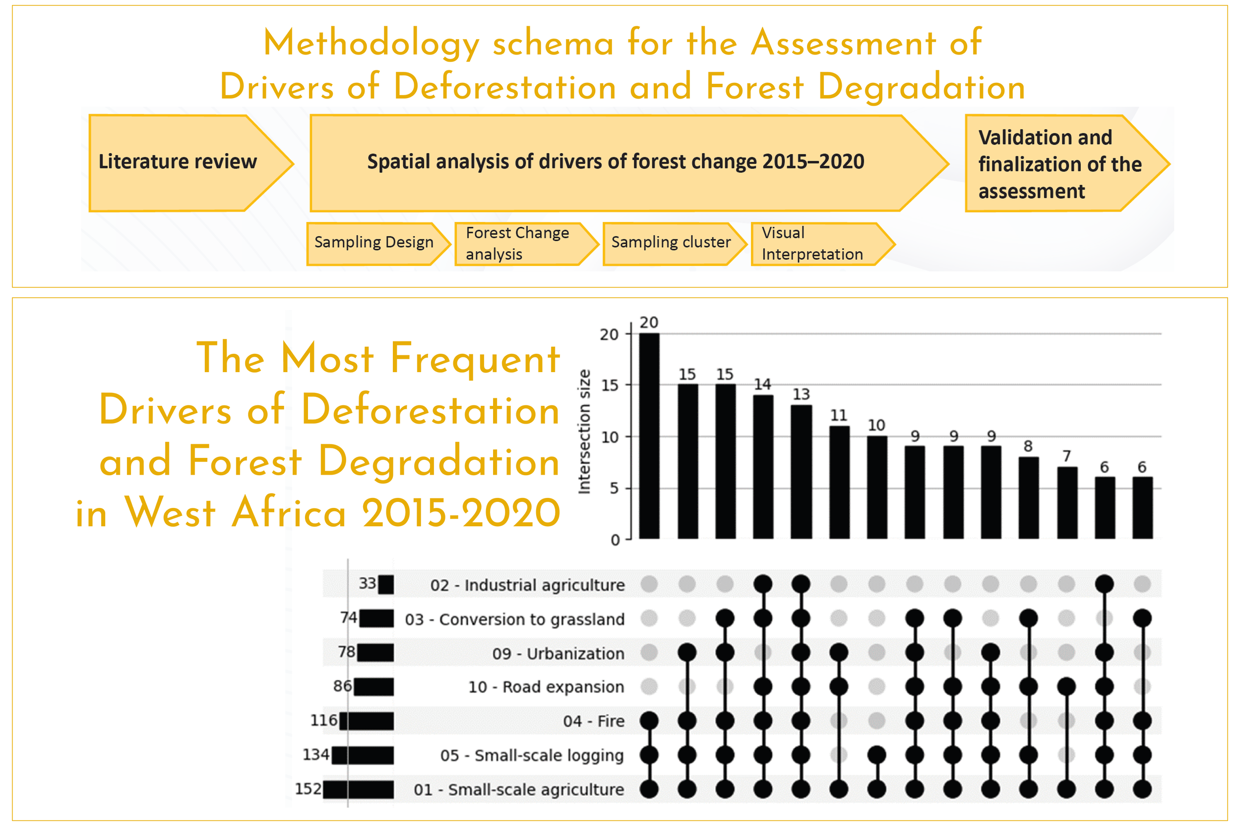
Assessment of Drivers of Deforestation and Forest Degradation in West Africa
This report presents the methodology and main findings of an assessment conducted between 2015 and 2020 to identify the primary drivers of deforestation and forest degradation in West Africa.
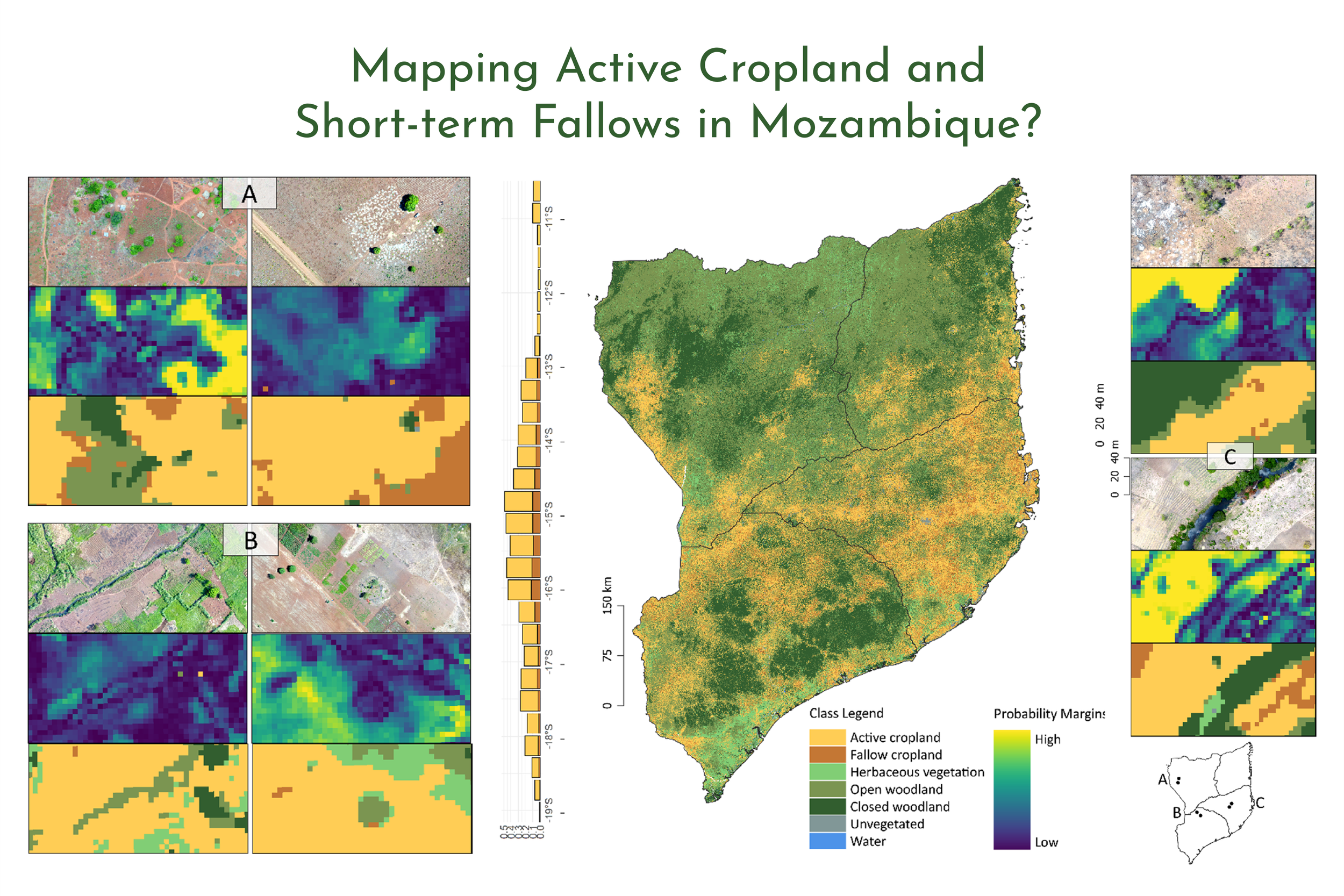
Large-Area Mapping of Active Cropland and Short-Term Fallows in Smallholder Landscapes Using PlanetScope Data
We present a large-area mapping framework to identify active cropland and short-term fallows in smallholder landscapes for the 2020/2021 growing season at 4.77 m spatial resolution.
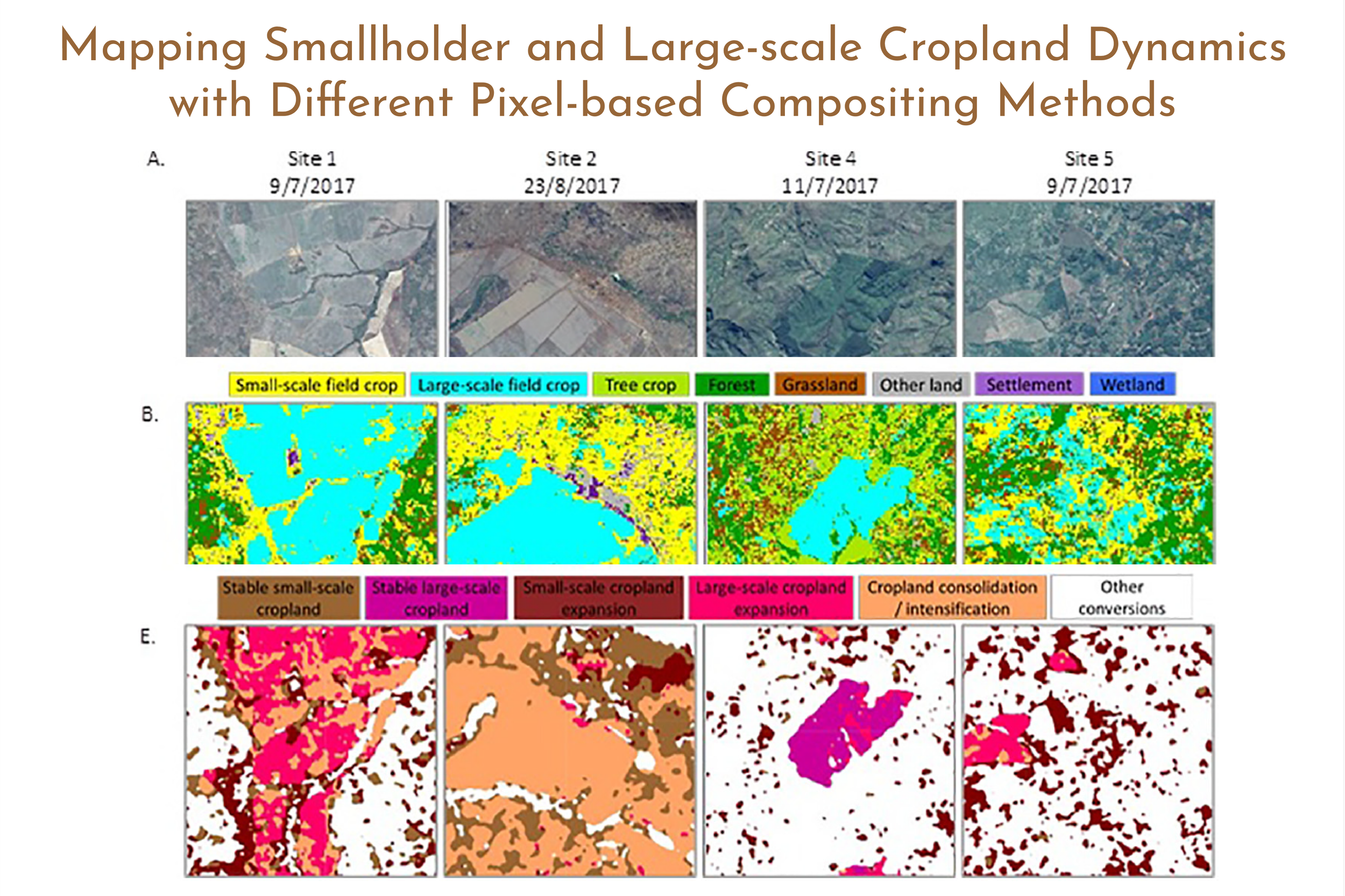
Mapping Smallholder and Large-scale Cropland Dynamics with a Flexible Classification System and Pixel-based Composites in an Emerging Frontier of Mozambique
(1) Pixel-based compositing impacts classification results. (2) Median compositing performed best for disaggregating cropland by field size. (3) Textural features facilitate the separation of small- and large-scale cropland. (4) Mapping cropland scale dynamics can improve understanding of land and food systems.

The Extent of Forest in Dryland Biomes
Dryland biomes cover two-fifths of Earth’s land surface, but their forest area is poorly known. Here, we report an estimate of global forest extent in dryland biomes, based on analyzing more than 210,000 0.5-hectare sample plots through a photo-interpretation approach using large databases of satellite imagery at (i) very high spatial resolution and (ii) very high temporal resolution, using Collect Earth software.
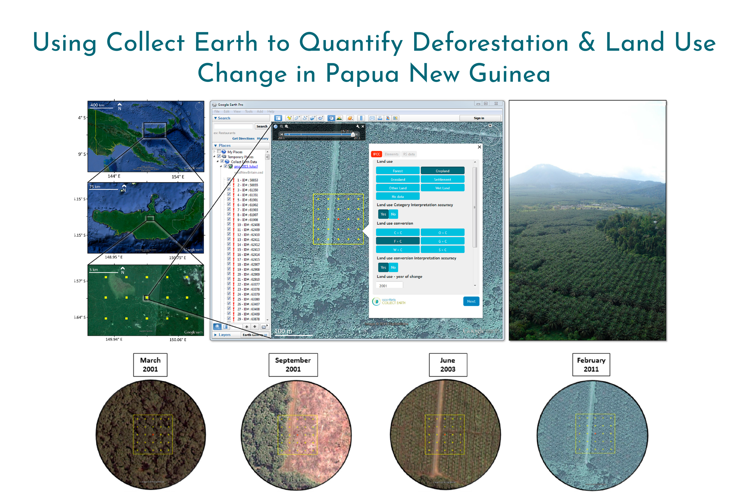
Collect Earth: Land Use and Land Cover Assessment through Augmented Visual Interpretation
Collect Earth is a free and open source software for land monitoring developed by the Food and Agriculture Organization of the United Nations (FAO). In this study, we provide a full overview of Collect Earth’s structure and functionality, and we present the methodology used to undertake land monitoring through augmented visual interpretation using Papua New Guinea as a case study.